
Satellite-based air quality monitoring offers you a exhaustive view of urban pollution by covering entire cities and nearby regions from space. It provides real-time data on pollutant patterns that ground sensors alone can’t capture, helping you identify hotspots and understand pollution drivers. This technology supports swift responses to pollution spikes and long-term policy evaluation. Keep exploring how satellites bridge gaps in air quality data and improve urban health management.
Key Takeaways
- Satellite data complements ground sensors to provide comprehensive urban air quality insights and identify monitoring gaps.
- It enables real-time detection of pollution spikes, supporting swift response and mitigation efforts.
- Combining satellite and ground data enhances accuracy in tracking pollutant sources and dispersion patterns.
- Long-term satellite observations evaluate policy effectiveness and identify emerging pollution issues.
- Satellite monitoring covers large urban areas, filling blind spots and ensuring no significant pollution events are missed.

Have you ever wondered how we track air pollution across vast regions in real time? Satellite-based air quality monitoring has revolutionized our ability to observe and analyze pollution on a broad scale. It provides a detailed view that ground sensors alone simply can’t match. When it comes to urban pollution, satellites play a pivotal role because they can cover entire cities and surrounding areas from space, offering a detailed perspective on pollution levels that might be missed by localized sensors. This capability is especially essential in densely populated regions where pollution sources are numerous and diverse.
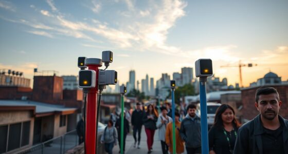
Satellite monitoring captures urban air pollution from space, providing comprehensive insights beyond ground sensors.
One of the key strengths of satellite technology is its ability to facilitate data integration. Instead of relying solely on scattered ground-based sensors, satellites gather atmospheric data that can be combined with local measurements to create a more complete picture of air quality. This integration helps identify pollution hotspots, track pollution trends over time, and understand how pollutants disperse across different regions. By merging satellite data with information from ground stations, researchers and policymakers can gain insights into the sources and impacts of urban pollution more accurately. This combined approach reduces blind spots in monitoring efforts, ensuring that no significant pollution event goes unnoticed.
Furthermore, satellite data enhances our understanding of how pollution travels and transforms across large areas. It captures variations in pollutants such as nitrogen dioxide (NO2), particulate matter (PM), and ozone, providing spatial and temporal context that ground sensors alone can’t offer. This helps identify patterns, like how traffic congestion, industrial activity, or meteorological conditions influence pollution levels in specific urban zones. The real-time nature of satellite observations allows authorities to respond swiftly to pollution spikes, issuing warnings or implementing mitigation measures promptly.
Data integration from satellites also supports long-term air quality assessments. It helps track progress toward cleaner air goals, evaluate the effectiveness of policies, and identify emerging pollution issues before they escalate. With continuous satellite observations, urban planners and environmental agencies can develop more targeted strategies, ensuring resources are allocated efficiently and interventions are more impactful.
In essence, satellite-based air quality monitoring bridges critical gaps in our understanding of urban pollution. By combining the broad coverage of space-based sensors with localized data, you get a more accurate, timely, and detailed view of air quality. This synergy enables smarter decision-making and fosters healthier urban environments, making it an indispensable tool in the fight against air pollution.
Frequently Asked Questions
How Accurate Are Satellite Measurements Compared to Ground Sensors?
Satellite measurements are generally accurate but can vary compared to ground sensors. You should consider satellite calibration to guarantee data reliability, and ground validation helps verify measurements. While satellites cover large areas and detect regional patterns, ground sensors provide detailed local data. Combining both methods enhances overall accuracy, giving you an all-encompassing view of air quality. So, satellites are useful, but their precision improves with calibration and validation efforts.
Can Satellite Data Detect Localized Pollution Sources Effectively?
Yes, satellite data can effectively detect localized pollution sources, especially urban hotspots and industrial emissions. You’ll see higher pollution levels over busy city centers and industrial areas, helping you identify problem zones from space. While satellites might not pinpoint every small source, they provide a broad view that complements ground sensors, enabling you to monitor pollution trends and target mitigation efforts more efficiently.
What Are the Limitations of Satellite-Based Air Quality Monitoring?
Like a blurry lens, satellite resolution limits your view, making it hard to pinpoint small pollution sources. Atmospheric interference acts as a fog, distorting data and reducing accuracy. You can’t always rely on satellite data alone, as clouds, weather, and resolution gaps obscure details. While helpful, satellites serve as a broad brush, and you need ground-based data to fill in the finer, more precise strokes.
How Frequently Can Satellites Provide Updated Air Quality Information?
Satellites typically provide updated air quality information every 1 to 7 days, depending on their revisit intervals. You’ll notice that data latency can vary, sometimes taking a day or two to process and become available. This frequency allows you to track trends and changes over time, but keep in mind that real-time updates are limited by satellite orbit schedules and data processing times.
Are There Privacy Concerns With Satellite Air Quality Surveillance?
You’re right to wonder if satellite air quality monitoring raises privacy concerns. While satellites mainly gather environmental data, some worry about surveillance ethics, fearing misuse of detailed images or data. It’s a delicate balance—regulating technology to safeguard individual privacy without losing sight of its benefits. As with any tool, transparency and strict guidelines help ensure satellites serve the public good rather than infringe on personal rights.
Conclusion
By now, you can see that satellite-based air quality monitoring is truly transforming how we perceive pollution. It bridges gaps that ground stations can’t reach, giving you a clearer picture of the air you breathe. Imagine a world where pollution levels are as transparent as crystal-clear skies—this technology makes that vision possible. As satellites keep advancing, you’ll witness an unprecedented leap toward cleaner air and healthier communities, revolutionizing the way you protect your environment.